


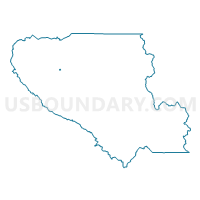
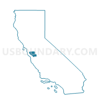
Voting District 42956, Santa Clara County, California
About
Outline

Summary
| Unique Area Identifier | 543354 |
| Name | Voting District 42956 |
| County | Santa Clara County |
| State | California |
| Area (square miles) | 0.06 |
| Land Area (square miles) | 0.06 |
| Water Area (square miles) | 0.00 |
| % of Land Area | 100.00 |
| % of Water Area | 0.00 |
| Latitude of the Internal Point | 37.32524800 |
| Longtitude of the Internal Point | -121.92904290 |
Maps

Graphs
Select a template below for downloading or customizing gragh for Voting District 42956, Santa Clara County, California


Neighbors
Neighoring Voting District (by Name) Neighboring Voting District on the Map
- Voting District 42830, Santa Clara County, CA
- Voting District 42850, Santa Clara County, CA
- Voting District 42855, Santa Clara County, CA
- Voting District 42885, Santa Clara County, CA
- Voting District 42900, Santa Clara County, CA
- Voting District 42905, Santa Clara County, CA
- Voting District 42910, Santa Clara County, CA
- Voting District 42915, Santa Clara County, CA
- Voting District 42925, Santa Clara County, CA
- Voting District 42940, Santa Clara County, CA
- Voting District 42985, Santa Clara County, CA
Top 10 Neighboring County Subdivision (by Population) Neighboring County Subdivision on the Map
Top 10 Neighboring Place (by Population) Neighboring Place on the Map
Top 10 Neighboring Elementary School District (by Population) Neighboring Elementary School District on the Map
- Campbell Union Elementary School District, CA (94,394)
- Luther Burbank Elementary School District, CA (3,823)
Top 10 Neighboring Secondary School District (by Population) Neighboring Secondary School District on the Map
Top 10 Neighboring Unified School District (by Population) Neighboring Unified School District on the Map
Top 10 Neighboring State Legislative District Lower Chamber (by Population) Neighboring State Legislative District Lower Chamber on the Map
Top 10 Neighboring State Legislative District Upper Chamber (by Population) Neighboring State Legislative District Upper Chamber on the Map
Top 10 Neighboring 111th Congressional District (by Population) Neighboring 111th Congressional District on the Map
Top 10 Neighboring Census Tract (by Population) Neighboring Census Tract on the Map
- Census Tract 5005, Santa Clara County, CA (5,275)
- Census Tract 5020.01, Santa Clara County, CA (5,022)